Some walks offer a gentle stroll and a nice view. The Pembrokeshire Coast Path offers 186 miles of cliffs, coves, sea birds, beaches, old harbours, holy oddities, and enough ups and downs to make your legs question your life choices. It is one of the great long-distance walks in Britain, and one of the most rewarding. Officially, it runs from St Dogmaels in the north to Amroth in the south, tracing one of the most varied shorelines in the country.
Quick takeaways
- Best for walkers who like big scenery, wild coastlines, and the satisfying feeling of earning their lunch
- Length 186 miles or 299 km
- Start and finish St Dogmaels to Amroth, though many people walk it in either direction
- Time needed around 10 to 15 days for the full route, though plenty of people tackle it in sections
- Difficulty moderate to challenging, with frequent climbs and descents despite what the map may optimistically suggest
- Why go for cliff-top drama, brilliant wildlife, historic harbours, sweeping beaches, and one of the finest coastal walking routes in Wales
First impressions
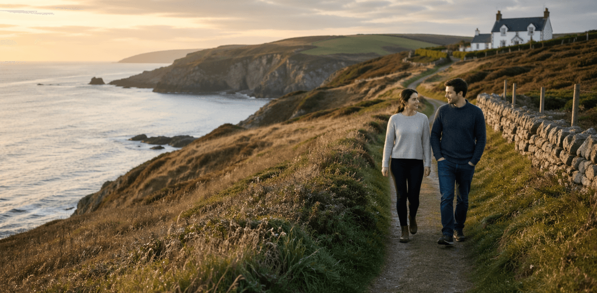
The first thing the Pembrokeshire Coast Path does, usually within an alarmingly short time, is make it clear that this is not a flat coastal promenade with a few handy ice creams along the way. It twists, dips, climbs, and generally behaves like a path designed by someone with a lively sense of drama. Official guidance recommends around twelve days at roughly 15 miles a day, but also notes that this is a challenging pace and that many walkers sensibly take longer.
That difficulty is part of its character. A mile here is not always an ordinary mile. It may involve a headland, a descent into a cove, a stream crossing, a steep pull back up, and a pause halfway through to stare at the sea and pretend that was the reason you stopped. It is, in other words, a coast path with opinions.
What makes it special
What lifts the Pembrokeshire Coast Path above mere exercise is the sheer variety packed into its length. The route covers 186 miles of coast, much of it within the Pembrokeshire Coast National Park, and the official path information describes it as some of the most varied coastal scenery in Britain. It is also part of both the Wales Coast Path and the International Appalachian Trail, which gives it the air of a walk that has collected extra qualifications just to show off.
You get cliffs and coves, certainly, but also broad beaches, little fishing villages, old industrial corners, bird-rich islands offshore, and occasional pockets of calm that feel as if the county is giving you a brief sit-down before sending you back out onto another headland. There are sections that feel raw and elemental, and others that feel unexpectedly companionable, with a pub, harbour wall, or village lane arriving at exactly the right moment.
The north and west
The northern end, around St Dogmaels, Newport, Fishguard and beyond, has a stern, weathered beauty. Official planning pages note some challenging stretches here, and the landscape looks the part, with rocky shorelines and exposed sections that feel properly coastal rather than merely near the sea.
Further west, the path enters some of its best-known country around St Davids, Solva and Whitesands. Here, the route feels broad-shouldered and bright, with a fine mixture of huge views and access to places where a walker can find food, shelter, or at the very least a civilised cup of tea. This part of the coast is also closely tied to Pembrokeshire’s wildlife story. The official path and park material repeatedly highlights the area’s importance for wildlife, while the wider coastal setting is one of the reasons the route feels so alive.
Solva deserves special mention because it has the rare skill of appearing exactly when you want it to. Arriving there from the cliff path, with the harbour tucked into its deep little inlet, feels like discovering a practical joke played in your favour. Pembrokeshire is very good at this sort of thing. It gives you a savage stretch of coast, then quietly places a picture-perfect village in the next fold of land as compensation.
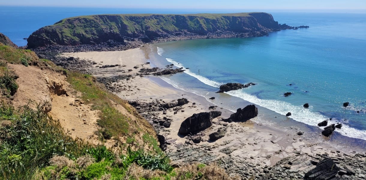
The southern drama
The southern stretches bring a different mood again. This is the part of Pembrokeshire that leans into spectacle. Around the south coast, the limestone cliffs and famous sea-carved formations give the walk some of its most theatrical scenery. Even official descriptions of the trail here talk up the dramatic coastline, and for once the tourism language is not overselling it.
There is also a pleasing contrast as the route moves toward friendlier beach country in the south and east. By the time you reach the final approaches toward Amroth, the mood has softened a little. There are still climbs, naturally. Pembrokeshire would never let you off that easily. But there is also a sense of the coast easing itself out, as though the path has decided that after all those cliffs and headlands you have earned a more companionable finish.
What to expect on the walk
This is a National Trail, but not one that invites absent-minded wandering. Official information notes that the path is split into 15 planning sections, which is useful because most people will be happier treating it as a series of manageable adventures rather than one heroic blur.
It is also a route where conditions matter. Parts of the trail have road alternatives, some stretches are affected by tides or diversions, there are even official alternatives linked to military range closures in some areas. That is not a criticism. It is part of what makes the walk feel real and working rather than packaged. You are dealing with an active coastline, not a stage set.
The good news is that it is surprisingly practical for such a wild-feeling trail. Rail links serve places including Fishguard Harbour, Milford Haven, Pembroke Dock and Haverfordwest, and official path information points to buses and access points that make section walking much easier than you might expect. This is one of the best things about it. You do not have to take on the whole epic at once. You can flirt with it in sections, revisit favourite bits, and gradually stitch together your own version of the full journey.
Planning your Pembrokeshire Coast Path walk? Download our free printable Pembrokeshire Coast Path walk planning guide for route advice, practical tips, and all the key information you’ll want to have to hand before you set off. It is a handy companion for planning at home and even better tucked into your bag for the trail itself.
Final verdict
The Pembrokeshire Coast Path is one of those walks that manages to feel both grand and oddly personal. Grand because the scenery is genuinely magnificent and changes constantly. Personal because what you tend to remember are the little moments. A harbour after a hard descent. A sudden beach. A headland with the wind trying to rearrange your face. A stretch of path so lovely it briefly makes you forget the last climb.
It is not the easiest long-distance walk in Britain, nor the gentlest. But it may be one of the most memorable. It combines wild beauty, practical access, wildlife, history, and just enough hardship to make the whole thing feel properly earned. By the end, whether you have done ten miles or all 186, you come away with the same impression. Pembrokeshire does not merely give you a walk. It gives you a coastline with character, and quite a lot of it.
Know before you go
Getting here
- Northern trailhead St Dogmaels, with the official northern end marked near Poppit Sands
- Southern trailhead Amroth
- Nearest rail links for sections of the path Fishguard Harbour, Milford Haven, Pembroke Dock and Haverfordwest
- By road best tackled section by section unless you are arranging baggage transfer or return transport
- Public transport the official path information highlights bus links and access points along the route, which makes day walks and shorter breaks quite practical
Where to stay
- Best approach base yourself in one or two hubs rather than changing beds every night unless you are walking the whole trail
- Good bases St Davids for the western sections, Newport or Fishguard for the north, Tenby or Saundersfoot for the south and east
- For full-route walkers mix guesthouses, inns and coastal villages, and book well ahead in peak season
Where to eat
- Best strategy treat village cafés, harbour pubs and bakery stops as morale management rather than optional extras
- Reliable food hubs St Davids, Solva, Fishguard, Newport, Tenby and Saundersfoot
- Top tip carry more snacks and water than your optimistic self thinks necessary, especially on cliff sections
What to do
- Walk a classic section St Davids to Solva for drama and convenience
- Go for big coastal scenery the western and southern cliff sections are the headline acts
- Take it slower choose one of the official planning sections rather than trying to overdo the mileage
- Look out for wildlife seabirds and coastal views are a huge part of the appeal
Places to see
- St Davids tiny city, huge character
- Solva harbour village with exactly the right amount of charm
- Fishguard and Newport excellent gateways to the northern sections
- Tenby and Saundersfoot ideal if you want beaches with your boot leather
Best time to visit
- Late spring to early autumn is the easiest window for longer walks, with longer days and generally kinder conditions
- Spring brings good walking temperatures and wildlife interest
- Summer offers the longest days but can be busier and more tiring
- Autumn can be beautiful and quieter, though weather becomes more of a factor
Year round note always check local path conditions, diversions and access information before setting out